Taking the Posties Path – Gabhail a’Chreig
,
In the 1860’s postman Kenneth McLennan carried the mail twice a week from Ullapool to Achiltibuie, a distance of 23km. Today’s Posties Path is still challenging but runs for a shorter distance, covering the 11km between Achduart in Coigach, and Blughasary at Strathcanaird.
Although both ends of the path are incorporated into core paths (Culnacraig Circular and Dun Canna Core Paths), the central section of the route is still a serious undertaking with treacherous sections. Improvement to the Posties Path are being implemented by the Scottish Wildlife Trust (in coordination with Keanchulish Estate) as a project within the Coigach & Assynt Living Landscape Partnership (CALLP) Scheme. The aim of the project is not to provide an aggregate-topped path, similar to other CALLP projects such as Acheninver Path or sections of the Suilven Path, but rather to improve access over the most awkward sections and obstacles.
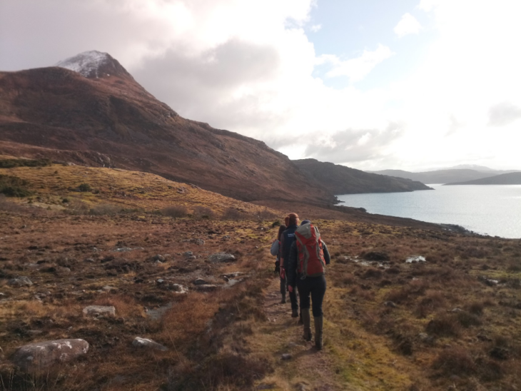
Early one sunny morning in March I walked the path with the Scottish Wildlife Trust North Reserves Team to review the work so far. Starting from Achduart on the Ben Mòr Coigach Estate we walked through a recently native woodland croft that has been planted as part of the CALLP Woodland Expansion Project. The path then crosses the common grazings. At the footbridge at the burn Allt a’Choire Reidh ancient oaks stand in the gully, the stunted remnants of Atlantic oak woods. Off the path, overlooking the burn, is the ruins of a prehistoric circular hut, a reminder of the long history of human habitation in Coigach.
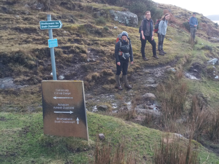
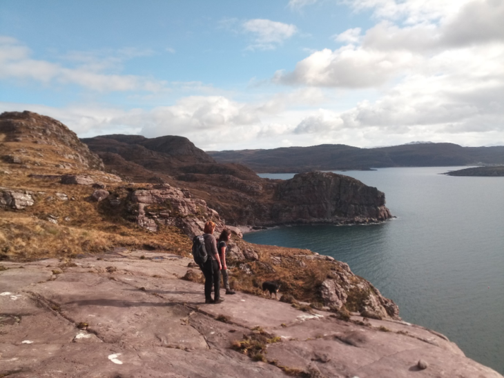
Across the burn and further on the path forks with the Culnacraig Circular Core Path running up the hill to Culnacraig, and the Posties Path continues along the coast. The path is well defined until the ford across the burn at Allt nan Coisiche. This ford should be noted as a “bail-out” point, as after heavy rain the ford may be unpassable. The path becomes less well defined from here and the flank of Ben Mòr Coigach becomes steeper. As we came to the bay at Geodha Mòr we saw 14 seals that had been sunning on the beach slip back into the water.
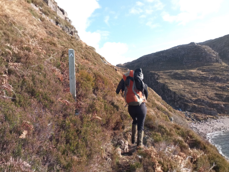
Walking around the bay there are a few precipitous sections, some of which have already been worked on. The contractor for the work is ACT Heritage, who in this instance have used locally won large stones to stabilise sections of the path. The path crosses the estate boundary at the burn Garbh Allt, into Keanchulish Estate. From here the path is quite indistinct and challenging but the view to the south over Lochbroom and Isle Martin, and back west to the snowy peak of Ben Mòr Coichach is worth the effort. As we followed the way markers we came across pine marten scats and spotted a sea eagle flying up to the peaks.
The next section of the path earns the accolade of “the Rock”, and here the path sections are intermittent between peat, deep peat and natural rock steps. At certain sections the contractor has placed larger stones to aid the awkward points on the path. However as we crossed “the Rock” the rain came in, and on went the waterproof trousers. As the path can be quite indistinct here it is necessary to keep your eyes on the way markers, and in rain and mist use a map and compass.
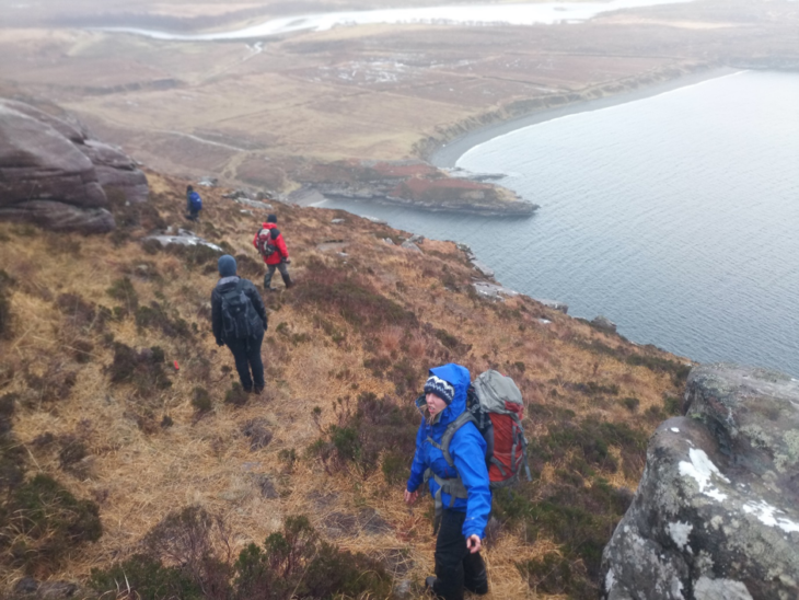
After an hour or so of slog over “the Rock” we reached Creag Dearg and peeked over the ridge to spy Dun Canna, the prehistoric fort on a promontory at Strathcannaird. When traveling north from Ullapool this ridge rises as the spectacular “crown of Ullapool” and is often the first view that travellers get of Ben Mòr Coigach from the south. Nevertheless, this section of the walk is treacherous when wet. Several of us took a tumble on the way down, and after a slip I found myself upside down, with water pouring up my leg. The consolation for the rough trod and frequent rain is a spectacular view of Strathcannaird, Ardmair, and on towards Ullapool.
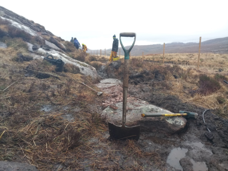
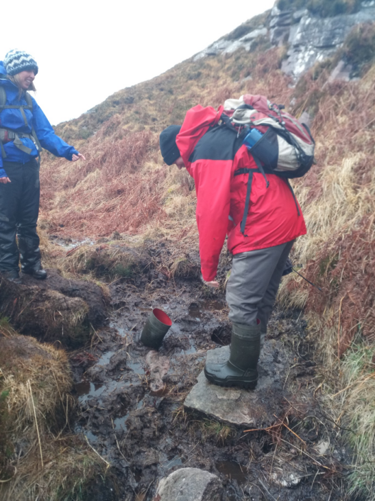
Following the path down the ridge, at the bottom we joined the Dun Canna Core Path, where we met the contractors working on the path. Here the path is also being improved with larger, locally won stones that maintain the look of a natural path and should need minimum maintenance in the future. Despite the improvement the purist, Highland hill walker can rest assured that there is still plenty of deep peat along the path!
After just over 11km, approximately 4hrs later, we passed the Keanchulish Deer Farm and reached the Blughasary Car Park.
Thanks must go to National Lottery players, EB Scotland and Ramblers Scotland for their financial support to the CALLP Posties Path Project. Thanks also to the Scottish Wildlife Trust North Reserves Team (Mark Foxwell, Michelle Henley, Marta Zabalegui and Beth Harwood) for guiding me along the path, and the hot chocolate along the way.